Home » Technology » Charting New Territory with UAV Photogrammetry

Charting New Territory with UAV Photogrammetry

A model of the Three Graces by Antonio Canova
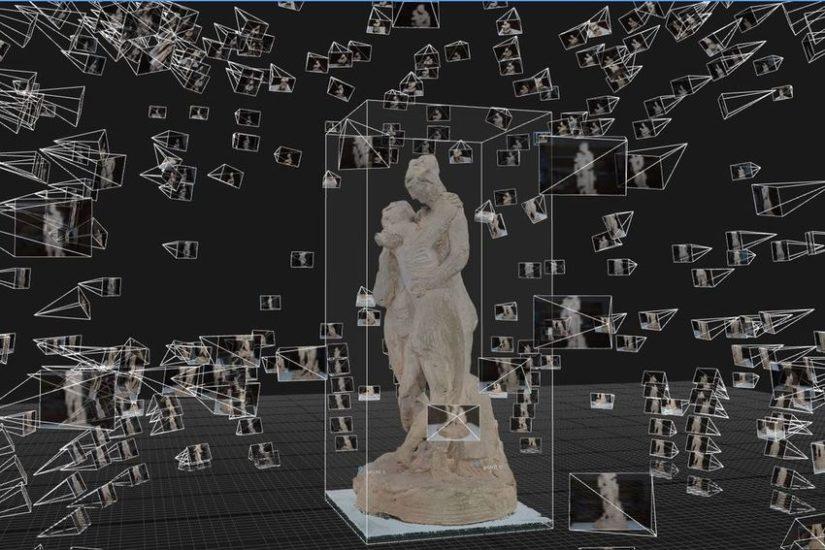
A sample of photogrammetry: The 'point cloud' of the Three Graces by Antonio Canova. Credit: The Factum Foundation
Share via:
Subscribe or log in to read the rest of this content.

Dave Clarke

Dave Clarke is a California-based writer who is fascinated by the way technology changes our lives.