NOAA Drops an Area-I Altius 600 Drone Into the Eye of Hurricane Ian

When most people learn a hurricane is headed their way, they grab what they can and hurry to get out of the way. Dr. Jun Zhang (University of Miami CIMAS, NOAA AOML), Dr. Josh Wadler (Embry-Riddle Aeronautical University), and lead meteorologist, emerging technologies, Dr. Joe Cione (NOAA AOML), aren’t most people.

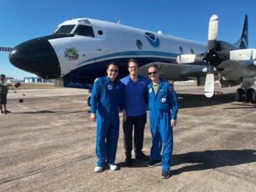
Hurricane researchers Jun Zhang (University of Miami CIMAS, NOAA AOML), Josh Wadler (Embry-Riddle Aeronautical University), and Joe Cione (NOAA AOML) after their successful launch of the Area-I Altius 600 uncrewed aircraft system. [Photo Credit: NOAA/AOML]
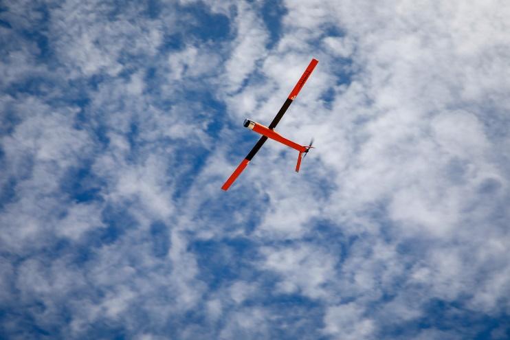
The mission: launch an Altius 600 uncrewed aircraft into the hurricane to understand how these massive, disruptive weather conditions develop and evolve and use that information to better protect life and property from the destructive effects, such as high velocity winds, can produce. The data will help NOAA better comprehend the processes – dynamical and thermodynamical – between the lower atmosphere and the upper ocean.
Developed and manufactured by Area I, the Altius (air-launched, tube-integrated, unmanned system) 600 weighs 27 pounds (12.25 kg), has a 7-lb. (3.17 kg) payload capacity, and utilizes dropsondes, instruments which use sound to measure and test physical conditions. Traveling at about 100 mph (about 160 km/ph), Altius has a range of about 275 (about 440 km) miles and can remain airborne for about 4 hours.
The hurricane hunters recon missions – ‘in situ’ as they say – are typically 7-9 hours in duration. It offers the scientists information about wind speeds and the hurricane’s track in order to best predict its path. After completing its mission, while the Altius can be guided to land on any flat terrain, that’s not a possibility for these NOAA concept of operations (conops) inasmuch as there is no flat surface within hundreds of miles, not to mention the 30-50 foot (about 9-15 meters) waves below, the sea salt, or the 100-200 mph (~160-320 km/h) winds whipping about during their missions.
The data they gathered from Ian’s late September/early October 2022 weather event will then be used to forecast future cyclones and hurricanes. By November 2022, Tropical Depression Nicole had evolved into a Category 1 Hurricane, again striking the Florida coast. The data gathered from Ian and other storms will be analyzed, assimilated, and then used to help protect life and property from the inevitable – future high-impact weather events.


